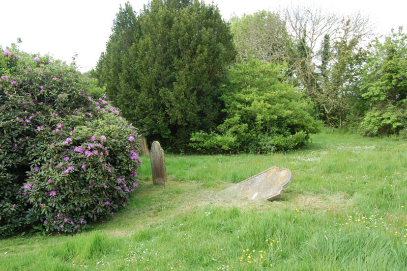
Rye Cemetery is set to expand when, at one point, it seemed the way forward was blocked. Alan Bolden explains the history behind this grave problem which, with the help of English Heritage, took him – and Rother District Council – into the “Time Team” territory of geophysics.
For several years now I have often wandered around our cemetery on Rye Hill, from standing by my wife’s grave lost to memories, to wondering about the future of this green and peaceful place.
Gradually my thoughts would come around to the obvious fact that little usable space is now left available for future needs, but subsequent enquiries showed that our “caring” Rother District Council (RDC) had no thoughts in that direction.
My comments to local councillors that the enclosed and untouched and beautiful field at the top of the cemetery proper would be ideal as a natural extension were just dismissed, as they knew that back in the 1850s onwards, it had been used for the easy disposal of penniless people who died in the adjacent workhouse!
Wandering around it, I could find absolutely no signs of any old disturbance, just seven obvious individual World War graves dotted here and there. From that, I began to check the official records, being assured that any such usage would have been known and recorded – nothing was!
Encouraged, I then sought advice from the senior officer of the English Heritage geophysics explorations department, who very kindly gave me great advice and help, including aerial photographs of our actual field, with plans of the whole area.
Their judgement was that there was absolutely no trace of any disturbance of the soil, but a modern geophysical exploration would prove it; and he suggested several suitable experienced companies worth contacting.
Greatly encouraged by this so-practical support, I wrote in early 2014 to the head of the relevant department at RDC, enclosing all my supporting documents, and requesting that serious attention be directed to what appeared to be a really practical way forward for the Council to solve this massive coming problem for the people of Rye and around. No response!!!
However, several months later I received a wonderful phone call from that department head, a lady, apologising for never having acknowledged my papers and request, and she wanted to inform me that her department was now examining the whole problem to be able to start preparing a course of action!
Thus after the subsequent geophysical exploration in late 2014, yes by that company I had suggested, a statement of the need and their proposal to meet it was presented in 2015 by the department to the Rother councillors, and it was fully accepted and agreed that our “unusable” top field would in due course be made ready for ongoing use as the much needed extension to Rye cemetery.
Following this complete acceptance and endorsement by Rother, I eventually wrote to that gentleman at English Heritage to express my great appreciation for his enormous help and encouragement enabling us to gain that so-essential technical support from the RDC staff supporting our case.
He was delighted to hear that our efforts had cleared away what would have soon become a truly awful situation for the people of Rye and around in the years ahead.
photo: Kenneth Bird


Hello
My eye was drawn to this article because I have been working for several months, together with Rye Foreign Parish Council and Rother District Council, on a project to provide a memorial sign on the open part of Rye Cemetery, the Third Division, to remember several hundred people buried in that section in unmarked graves.
To cut a long story short, I have found Rosemary Burt from Rother extremely helpful and I have examined several plans and ledgers of burials at her office. Unfortunately the personal detail and dates have not been matched to the plot numbers – a computer database expert would find this easy.
The sign has been designed and ready for approval, funding agreed and erection should be possible later this year.
I found the article by Mr Bolden baffling. The grave cuts (hundreds of them, aligned east – west in neat rows) are clearly visible with the naked eye in dry summer weather.
I fail to understand how a geophysical survey did not detect them.
Also I would like to ask, if the paupers from the Rye Union Workhouse were not interred here, then where were they?