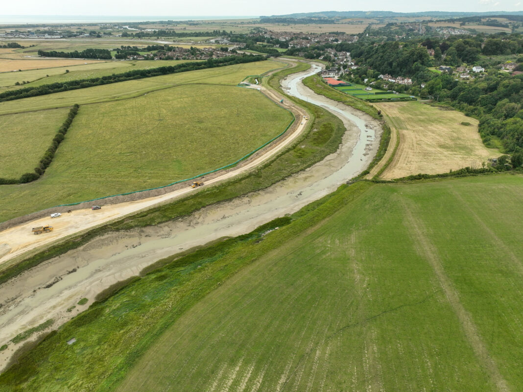
The Environment Agency (EA) and its main contractor VolkerStevin report almost a third of the work on raising and widening the river Rother’s eastern tidal embankment near Rye has been completed.
Earthmoving on the £32m Rother Tidal Walls East (RTWE) project started in March this year and work is due to finish in August 2025. The current riverbank defences are being raised by up to 50cm to 5.8m above mean sea level and doubled in width to 15m. An impressive 140,000 cubic metres of clay will be used to create the stronger barrier — the equivalent of 56 Olympic-size swimming pools.
Construction of the new tidal defence is currently being carried out along three miles of the river’s east bank between the tidal limit at Scots Float Sluice beside Military Road and the harbour master’s office in Rye Harbour. The Rother’s western bank was raised and strengthened in 2007.

Bank raising work has also taken place on the north side of the Union Channel between Union Channel Sluice and the nearby pumping station. The sluice to railway bridge section is due to be completed by the end of October.
An innovative environmental aspect of the project is the plan to build an 80m-wide “erosion set-back” in Camberfield south of Monk Bretton Bridge, creating an additional four hectares that will be allowed to regenerate to saltmarsh. Just to the north, a 150m stretch of bank between this bridge and the railway bridge, behind King’s Avenue, will feature a low brick-clad concrete wall on steel sheet piles.
Local people may have already spotted trucks carrying clay to one of the site’s four main access points — Scots Float, a track off the A259, another beside the rugby club on New Road and one off Camber Road. The clay, which has special properties, comes from a quarry near Pluckley in Kent. A planning constraint means that only 65 truckloads are allowed each day, with each vehicle carrying 20 tonnes of material to Rye.
EA and VolkerStevin are endeavouring to keep transport disruption to the minimum and they have also made great efforts to conserve the local environment by trapping animals and carefully relocating them away from the works. Creatures such as the rare great crested newt, lizards, snakes, slow-worms and badgers have already been moved to safer locations. Efforts to reduce the operation’s carbon footprint are also being made — such as the use of electric cars onsite and a plan to deploy a “solar pod” to power the Camberfield site office.
Earthworks on the project are halted between 1 November and the end of February in order to protect over-wintering birds. While recognising the importance of this break, Volker’s site agent Barry Glew points out that it does constrain the amount of clay that can be stockpiled on site during the year, leading to a longer construction time.
Building new tidal defences on the river is vital to protect Rye and the extensive low-lying marshes from flooding, with 14,500 homes, numerous businesses and a large swathe of farm land at risk. The RTWE project forms part of the larger Folkestone to Cliff End flood risk management strategy (FOCES), a 100-year scheme designed to protect this part of East Sussex and Kent. Other communities that will be protected include Hythe, Dymchurch, St Mary’s Bay, Littlestone, Lydd, Camber and Pett.
IPCC chairman Jim Skea recently conceded that global temperature looks set to increase by at least 3C by 2100, double the current rise. If this occurs, one estimate suggests that sea level could increase by around two or three feet by 2100. However, there are uncertain factors such as the impact of Antarctic glacier collapse, ice sheet melt and ocean current circulation, which could produce far higher oceans.

Ian Nunn, EA’s project sponsor for RWTE, says the main issue regarding tidal flooding is not necessarily sea level rise, but “storminess”. It’s the additional energy in storms, producing greater rainfall and tidal surges, that creates most flood risk.
“We plan to raise the banks again in 35 years; the project is part of a 100-year plan of continued investment to protect the area from the sea,” Mr Nunn reveals.
“We want to build a scheme that will protect residents for the next 100 years, and which they’ll recognise as a benefit to the community — giving better access, improved biodiversity and a positive impact on the environment,” he says.
The EA’s avowed goal is to protect our vulnerable region against a one in 200 year flooding event. This is the accepted UK standard at present. But as the agency points out, nobody can guarantee that a one-in-201-year event will not occur — in which case the flood defences may be overtopped.
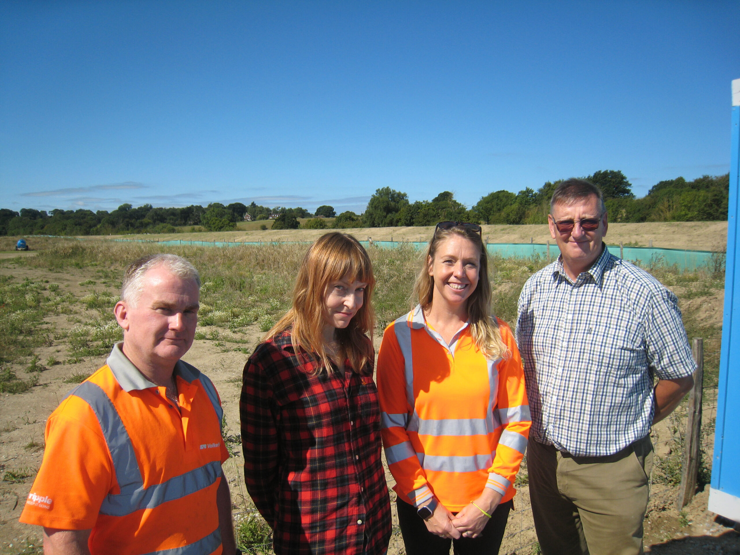
Building the higher riverside bank continued despite a very wet July. Between the EA and VolkerStevin about 50 staff are working on all aspects of the flood defence project. Right now four excavators, three 50-tonne dump trucks and a roller are being used, although equipment varies when different work is required. Machines are also deployed to damp down dust and sweep up any material spilt on the roads.
The high standard of tidal embankment construction being carried out gives confidence that the area’s flood defences will protect local people well into the future.
Several centuries ago, Romney Marsh was described as “the gift of the sea”. What the sea gives it can take away, but it’s reassuring to know that the Environment Agency and its contractor partner are working hard to ensure this precious gift remains part of terra firma.
Members of the public can visit the interesting Rother Tidal Walls East visitor centre at VolkerStevin’s depot at Scots Float Sluice on the east side of Military Road between 8am and 4:30pm, Monday – Friday. Please ask for Michelle Miller.
Any enquires regarding the project can be emailed to rothertidalwallseast@environment-agency.gov.uk
Image Credits: VolkerStein/RTWE project , David Worwood .


