Over the past week, a team of palaeo-environmentalists (people who study prehistoric environments) have been busy mapping the remnants of ancient trees at Pett Level’s submerged forest, cutting tree ring samples and pushing augers into the peat layer around the trees to extract pollen, seeds, plant material and fragments of long-dead insects. All this evidence will be used to work out the type of forest that once existed at Pett Level, how long it lasted and how it was destroyed. The project will also establish the history of the local sea level in the millennia after the last Ice Age. Tentative conclusions suggest it was fairly open oak forest, dating from about 8000 BC and lasted at least 2,000 years.
The team, under Dr Scott Timpany of Orca Marine in the Orkneys, has been commissioned by English Heritage to survey the Pett Level remains before they are eroded away. They will be continuing their work next week, during low tide, starting at 08:30 each morning (from Monday September 29 to Friday October 3). Volunteers will be very welcome, as there is lots to do.
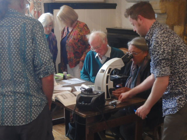
Over the weekend, Scott ran drop-in sessions in Winchelsea, as a guest of the Winchelsea Archaeological Society. Over 100 people visited, to look down microscopes at the samples taken and talk about the methods being used, as well as what the evidence so far shows.
Scott also gave a talk to a packed room about the Pett Level survey and the work that has been done on ‘lost lands’ around the country. While most research has focussed on the buried peat layers around the submerged forests, little has been done since the 19th century on the trees themselves. Scott’s team estimate that they will have mapped over 200 trees at Pett Level by the end of their two weeks but thinks there are over 1,000 still accessible at low tide. He hopes that local enthusiasts will continue the work and send their results to him to add to his survey.


