Have you noticed that the number of daytime road closures seems to be on the increase? Not just at night, but during daytime hours as well. And not just minor roads – but trunk roads. It really pays to study the local notices issued by East Sussex County Council (ESCC) these days, to make sure that you’re not going to be sent on a wild goose chase around the countryside. But even that doesn’t always help.
My local road, the A268 through Playden, Rye Foreign and Peasmarsh, has had more than its fair share of roadworks over the last few years. No doubt being used as a diversionary route for heavy vehicles displaced from other trunk roads hasn’t helped, but we’ve suffered a continuous series of traffic lights due to resurfacing and water main works. Don’t get me wrong, the work needs to be done, and to be fair the number of actual road closures has been minimal. Until now.
Notices published by ESCC Highways show three phases of closure in the near future for resurfacing works. Depending on where you live and where you’re coming from, a detour of 20 miles is a real possibility when the closure is in effect. Check locally for details.
But returning now to Rye Foreign this morning, I wasn’t aware of any published closures in effect – until I arrived at the bottom of the Landgate and found Road Closed Ahead and Diversion (Right Arrow) blocking the entire nearside lane of the A268 before the railway bridge. With the funfair clearing the Salts, these signs were causing chaos – and blocking access to Rye Hill, the Rye Medical Centre, Deadman’s Lane, Military Road, and all access points north to Iden and beyond, as well as the A268 itself.
The driver of the car in front of me had obviously had his patience exhausted. He simply moved the signs onto the pavement and this instantly cleared the congestion (which by now extended back into Cinque Ports Street). We then drove north, unimpeded by any obvious road closure. which did make me wonder what this was all about.
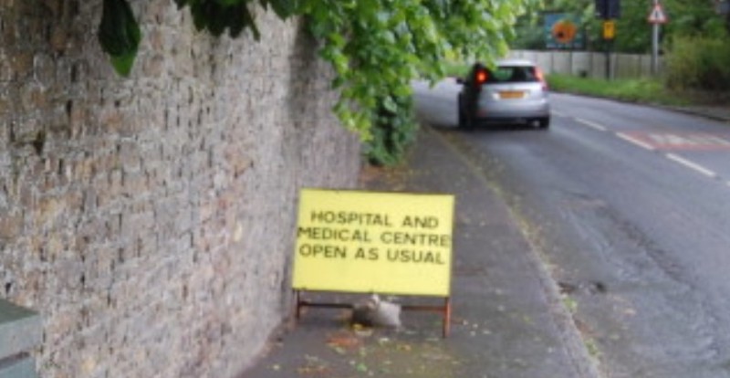
So I rang ESCC Highways and related this to them. They were very helpful and said they would look into it. There were closures in force on the A268 in Peasmarsh that day, so that was probably what the signs referred to, they said. Why they had indicated that everything north of the railway bridge was closed was inexplicable – surely any signs were warranted only where the A268 dives left at the Peace and Plenty? [Editorial note: Since then new signs have appeared by the railway bridge saying that the hospital, medical centre and local businesses are still accessible]
And I also asked the very helpful gentleman at ESCC Highways why resurfacing works now frequently result in total road closures, rather than traffic lights and “one carriageway at a time” as it used to be. I was expecting an answer referring to health and safety requirements, but that wasn’t it. Apparently the reason is that the A268 is too narrow to operate the type of resurfacing machinery that the contractors now use. Now, is that really a valid reason?
To my simple mind, this means that either the equipment they use isn’t really fit for that particular job as it is too wide, or that the A268 has shrunk in width since it was last resurfaced. Either way, next time you find yourself a half mile from home with a Road Closed board adding another 20 miles to your journey, you’ll know the reason.


