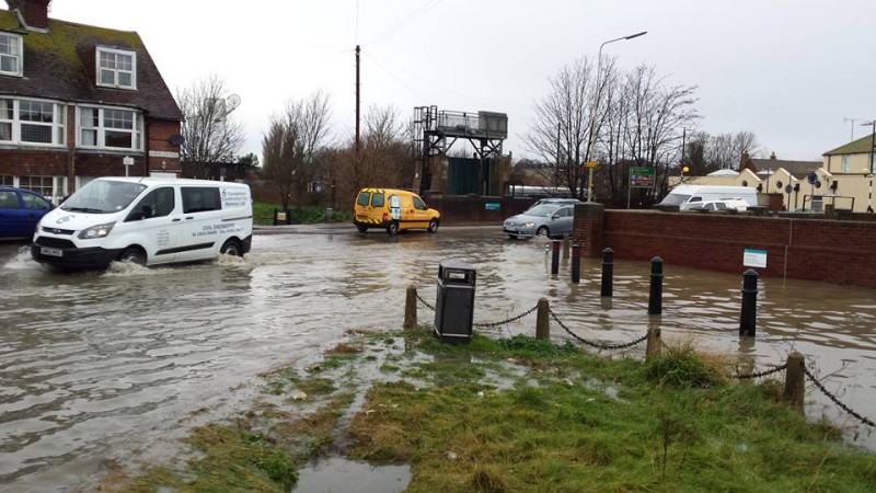
Friday the Thirteenth may be a wait and see day in Rye as threats of flooding move down England’s East Coast – but may not reach here until Friday night or Saturday morning.
The traditional day of bad luck (for the superstitious) kicked off with news of more homes being evacuated in vulnerable parts of Essex – and flood warnings on the Kent coast down as far as Deal.
Rye’s Harbour Master will no doubt be watching Friday’s high tides at 11.34 am and 11:56pm with care – and the Environment Agency may well be considering closing flood gates as a precaution.

But the Agency’s warnings Friday morning were still at Low risk/Very low risk levels notwithstanding the precautionary evacuations in East Anglia – though this may change.
Thursday night saw reports of the Army helping people evacuate along the Lincolnshire coast, followed on Friday morning by reports of homes being being evacuated much further south in Essex because of the storm surge predicted. Surges happen when high tides and gale force winds combine, and water may be forced from the North Sea into the narrow English Channel if the surge is southwards.
Television news also reported flood warnings for the coast around Thanet as the surge moved South with high winds and high waves potentially threatening low lying areas not protected by sea walls such as Camber. Seafront roads, and particularly The Suttons in Camber, may have lovely sea views, but these can be less appealing in bad weather. Other areas like Winchelsea Beach and Rye Harbour may be protected, as in recent years, by the sea walls however.
Rye’s Emergency team REACT warned on their Facebook page on Thursday that there was a possible threat if the surge reached the South Coast.
Snow and ice are also causing problems with trains affected in the Hastings area and icy roads. Thanet, as often happens because it is so exposed, had heavy snowfalls and there were reports of blocked roads and treacherous ice.
No one knows though how bad the storm surge will be and how far its effects will be felt – or when – so Friday The Thirteenth will be very much a waiting game with any danger possibly past by late Friday or the middle of Saturday.
Photos: John Minter and Rye News library
Image Credits: Rye News library .


A change in wind direction seems to have taken away the threat of East Coast flooding but flood warnings are still in place today, Saturday, for Kent and Sussex when the highest tides of the month are expected. But the snow in Rye did not last long did it ! However I’m sure the Agency (see photo above) will be keeping a watchful eye on the rising waters. In the meantime it may be very cold so be wary of ice