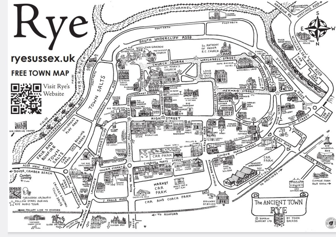
Like Mapp and Lucia, the Rye town map we all know and love has become a bit of an institution. It was initially produced in 2001 to promote the ryesussex.uk website as at that time no-one in Rye really knew that Rye even had a website. Olly Campion decided to literally put Rye on the map and set about the daunting task of producing the little brown folded map which you see all over town and which has been so hugely popular with so many locals and visitors for over 22 years.
Since 2001, Olly has printed and distributed 1.25 million copies with almost every tourist seen clutching one in their hand! The original map was drawn by John Breeds whose family is closely woven into the history of the town and went on to become the mayor in 2010.
Olly painstakingly draws all the new buildings and changes to the map each year, trying to keep as much as possible to the same style as the original. Such is its popularity, this year the map has had a surge of new additions and has more entries than ever before becoming fully booked and artwork finished within a month!
Available in outlets all over town, the map is an essential and unique work of art, produced by a local for locals and this year has a special poignance with space being given to the “Save the Mary Stanford Lifeboat House” appeal.
Image Credits: Domain Support Ltd/John Breeds .


Love the map, but I’m tired of informing visitors that it is ‘upside down’, that is North is pointing down, against all conventions.
Is this a cunning way of confusing them?
According to The Keep (East Sussex Record Office) early estate maps of the area often placed the South at the top of the map, as Sussex looked to the sea rather than to London. Perhaps it’s an extra selling point for visitors that the Rye Town Map continues this tradition?
https://www.thekeep.info/places/eastsussex/
It’s pretty straight forward really. This is an elevated view of the town and, as such, if the map were drawn in the opposite orientation, all the shops and attractions would be hidden behind the hill that Rye sits on. Which wouldn’t be very practical. Other reasons are that the church faces north, most of the roads and the railway come into the town at the north and, as such, the presentation to the visitor is much more palatable to them when the “entrances” to the town are shown from the bottom … as is done with almost all attraction maps.
Anyway, maps have been drawn of Rye like this for centuries, it’s quirky and we like it.